Latest Congressional Dedistricting Map Splits Stark
March 3, 2022 5:29AM EST
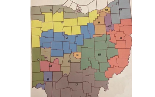
Courtesy Ohio Redistricting Commission
COLUMBUS, Ohio (News Talk 1480 WHBC) – The Republican members of the Ohio Redistricting Commission on Wednesday approved a new Congressional district map.
All Democrats on the commission voted against it though.
Under the map, Stark County would be split between the 13th and 6th districts.
The 6th reaches the southeast half of the county.
That’s the sprawling district that goes from Youngstown to Marietta.
And the 13th covers the northwest half of Stark and all of Summit.
The Ohio Supreme Court must approve.
The Columbus Dispatch says the GOP would likely hold on to at least ten of the state’s 15 seats.